 |
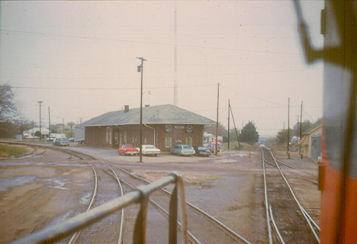
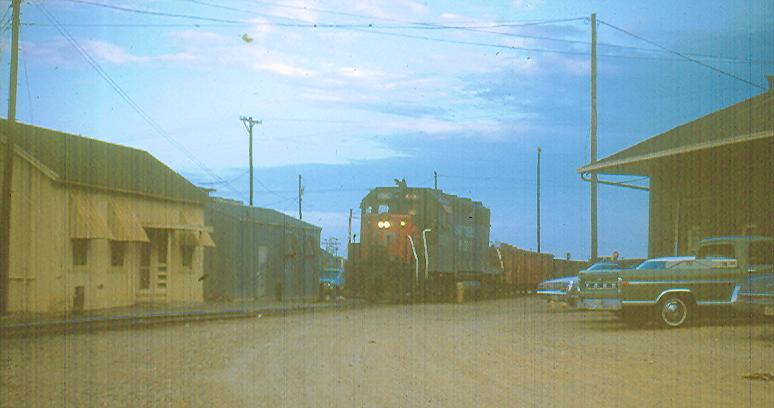
This priceless shot from the cab of Robert
McFatridge's engine shows the old Sherman Branch
extending straight ahead and the active main curving to the left of the
depot. The Sherman Branch was abandoned on September 25, 1953.
The track at the time of this photo extended only about 1/4
mile ahead and was used for switching and as a lead to access the engine service facilities
and the old Texas Midland/Texas & New Orleans branch to Paris, both to the
right. The service lead is the second visible turn-out from the engine
and Paris branch is just beyond that, but not easily discernible in this
photo. Originally (late 1890's to early 1900's), the Paris line ran straight through
and paralleled the Cotton Belt on to Greenville. Later, the TM and SSW
lines between Commerce and Greenville were consolidated and the TM tracks
removed in favor of the SSW route.
The only railroad structure shown in this photo that remains today is the
small metal building visible between the nose of the engine and the yellow
wooden structure. photo: Ed Cooper |
|
See the Depots
of Commerce page for photos and history of Commerce Depots. |
|
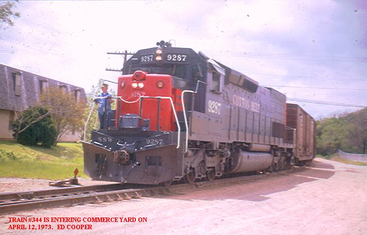 |
SSW #9287 leading eastbound #344 in front of the
depot on April 12, 1973. photo: Ed
Cooper |
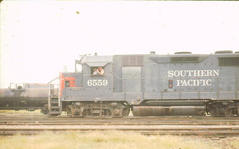 |
C. W. "Red" Standefer (wearing hat) and another
unidentified crew member on SP #6559 leading the Commerce-Greenville Dodger
in the late summer of 1972.
photo: Ed Cooper |
 |
Commerce yard on October 5, 1972.
photo: Ed Cooper |
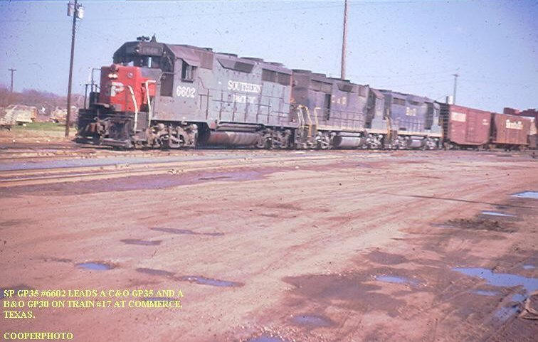 |
Train #17 in Commerce yard.
photo: Ed Cooper |
 |
SP#6600 on the old Sherman lead on the back
(North) side of the Commerce Depot. Of the structures shown in the
photo, only the small
metal building to the left of the engine remains.
photo: Ed Cooper |
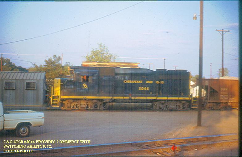 |
C&O#3044 switching on the old Sherman lead.
photo: Ed Cooper |
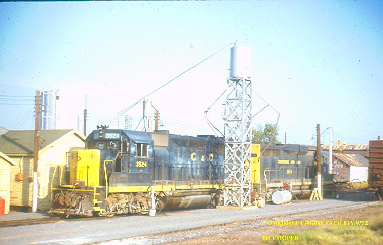 |
Chesapeake & Ohio engines stopping for
refreshments at the engine service facility in September, 1972. This
facility was located on the northern side of the yard. The facility
even featured an open pit for beneath engine access. The pit was
located beneath these engines. photo:
Ed Cooper |
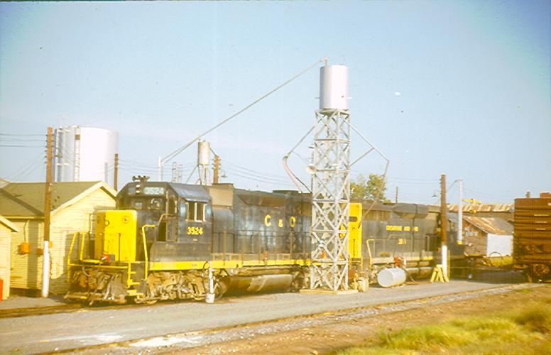 |
Sticking around for a little R&R.
photo: Ed Cooper |
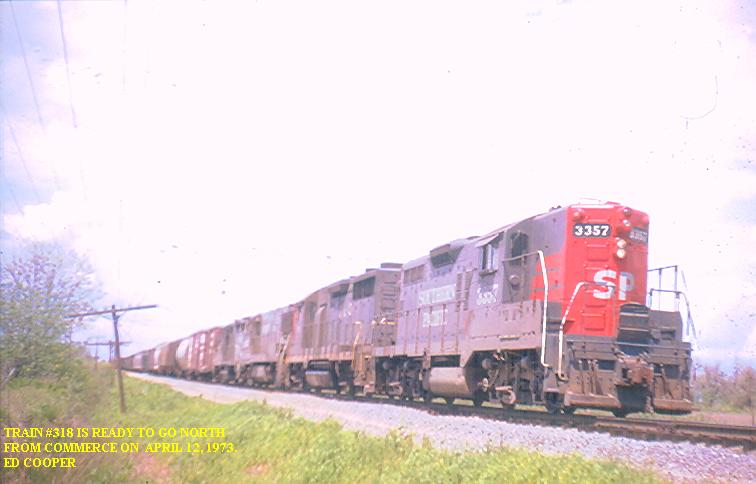 |
Train #318 lead by SP#3357 on April 12, 1973.
photo: Ed Cooper |
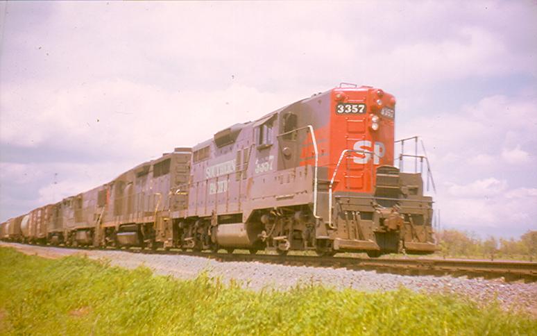 |
Train #318 lead by SP#3357 on April 12, 1973.
photo: Ed Cooper |
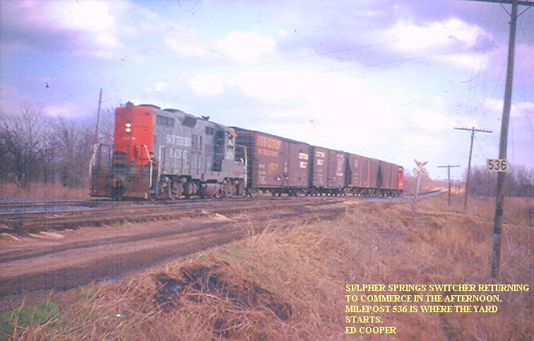 |
Sulphur Springs switcher coming home at the east
end of the yard. The field to the right in this picture was the
location of the old roundhouse and turntable. This facility had been
removed upon the dieselization of the Cotton Belt several years prior.
The only sign of the facility remaining today is the small lake used to
supply water for the engines. We locals still know and refer to this
lake as "Roundhouse Pond." photo: Ed
Cooper |
 |
Cotton Belt "Blue Streak" #343 westbound coming
into the east limits of the Commerce Yard on March 21, 1973. This
photo was taken near the same grade crossing shown in the above picture. photo: Ed
Cooper |
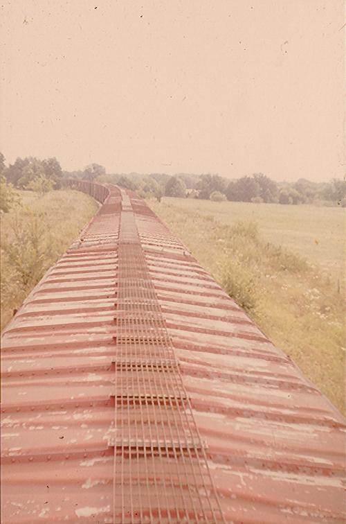 |
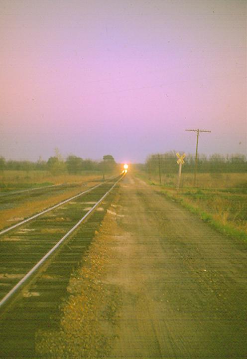
This photo was taken just east of Commerce on the
recently closed Paris branch line formerly the Texas Midland/Texas & New
Orleans. About six miles of track was retained for several years after
1971 for car storage as seen here. The segment used for storage ran
from the edge of town to the southern edge of the Middle Sulphur River
bottom north-east of the Horton Community in the south-west corner of Delta
County. The reason for the line's closure
can be seen in the photo below...
photo: Ed Cooper |
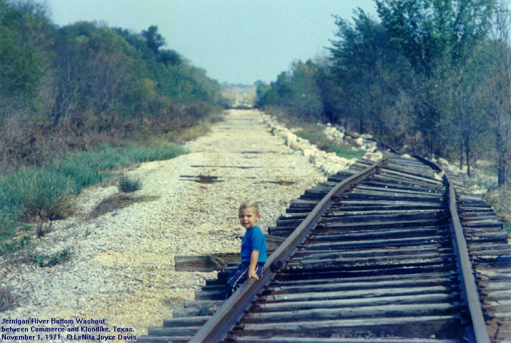 |
This photo of me was taken by my
mother on November 1, 1971. This is a view to the North-east on the Texas
Midland/Texas & New Orleans line from near the Southern crossing of Dogtown
Road looking toward Klondike, TX. This location is in the Jernigan River
Bottom about 8 miles North-east of Commerce. The dark section on the
roadbed is the Jernigan River bridge structure. Klondike is
approximately located at the tree line visible at the far end of the roadbed
at which point the line made a turn to the East to continue on to Cooper.
The right of way shown here is now Federally protected property bordering
Cooper Lake and has taken on a jungle-like appearance.
Service by the Southern Pacific from
Commerce to Paris via the old Texas Midland/Texas & New Orleans line halted
as a direct result of a major flood in 1971. Washouts of the line at the
North Sulphur River and Jernigan River occurred during the same weather
event. Up until the time of the washouts, there was a daily train from
Commerce to Paris servicing Campbell Soup's facility in Paris.
Approximately three car loads of produce and other ingredients each day went
into the Soup plant and six to seven car loads of canned soup came out.
These cars were part of a block in the Blue Streak (#343) set out & picked
up in Commerce. Motive power for the Paris run was provided by the same
engine at that provided daily power for the "Dodger" to Greenville.
Southern Pacific crews ran service from the Cotton Belt interchange at
Commerce and used their own SP caboose which was kept at the Commerce Yard.
photo: L. Joyce Davis |